Chapter 1
Before the White Men Came
Indians of various tribes and cultures inhabited the Norfolk area for thousands of years before the arrival of the first white men. Because of a lack of written records, however, little besides archaeological evidence of their existence is known today about them.
The earliest definite record of an Indian settlement on land now occupied by Norfolk is found in the writings of Captain Arthur Barlowe, who, with Captain Philip Amadas, headed Sir Walter Raleigh's first exploratory expedition in 1584 to what are now known as the Outer Banks and Eastern North Carolina.
Barlowe recorded in his report to Raleigh, written the same year after his return to England, that the main town of the Chesepian Indians, the tribe that then occupied the area now including Norfolk, Portsmouth, Chesapeake, and Virginia Beach, was Skicoak, "which the people say is very large, though none of the natives have seen it. But they have heard about the great size of the city from their fathers, who reported it takes about an hour to journey around it."
In explorations made in 1585-86 by Ralph Lane, the governor of Raleigh's first Roanoke Island colony, it was also learned that the Chesepians had two towns besides Skicoak. These were Apasus and Chesepioc, both near the Chesapeake Bay in what is now Virginia Beach.
All three of these towns, which were palisaded or fortified with stakes driven closely together into the ground, are shown on the first printed map of the North Carolina and Virginia coastal areas, engraved in 1590 by Theodore De Bry from watercolor maps drawn by John White during Lane's explorations northward from Roanoke Island, that penetrated the Chesepians' hunting grounds.
The Chesepians who inhabited these towns took their name from the great bay, which means Mother of Waters, that washed the northern boundary of their territory. But they were not to occupy it for long after Barlowe's and Lane's reports to Raleigh were written.
According to "The Historie of Travaile into Virginia Britannia," written in 1612 by William Strachey, the Chesepians were wiped out by Powhatan, the head of the powerful Powhatan Confederacy, a few years before the arrival of the English at Jamestown in 1607.
The Chesepians were exterminated because Powhatan's priests had warned him for years that "from the Chesapeack Bay a Nation should arise, which should disolve and given end to his Empier."
It is possible that Skicoak was destroyed at that time. In any event, its name disappeared from the records before the settlement of Jamestown. And by the time Captain John Smith's map of Virginia was issued in London in 1612, the town, or "King's House," of the tribe on what is now the Elizabeth River, was called "Chesapeack."
It is also known that after the massacre of the Chesepians in the 1590s, Powhatan peopled what is now the Norfolk area with warriors of his own whom he could trust, although they continued to be known as Chesepians.
Traditionally, Skicoak, the main town of the Chesepians, was on the north side of the Elizabeth River where its eastern and southern branches converge on the exact site where Norfolk was laid out in 1680-81.
Later historians and archaeologists, however, believe that the town was farther down the river toward Hampton Roads, somewhere between the present sites of Fort Norfolk and the Lamberts Point coal piers.
Chapter
2
Exploring with the Smith Party
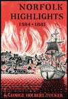
Norfolk Highlights 1584 - 1881

See the "Table of Contents" for links to every chapter in Norfolk Highlights 1584 - 1881 by George Holbert Tucker.
